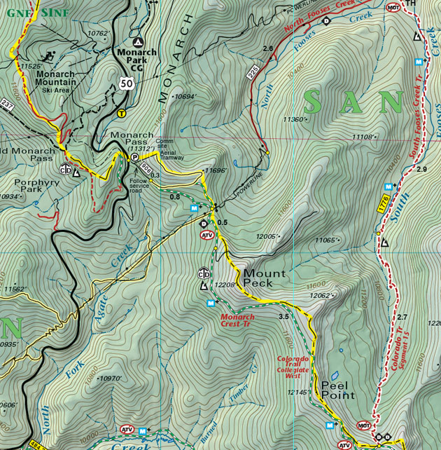
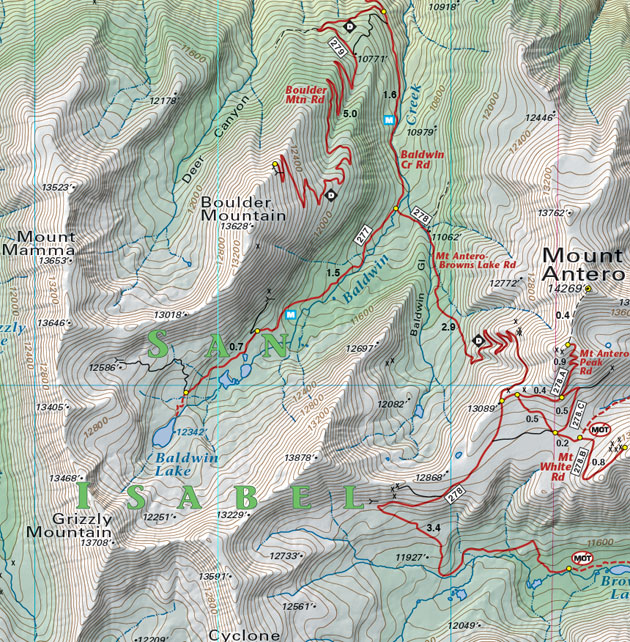
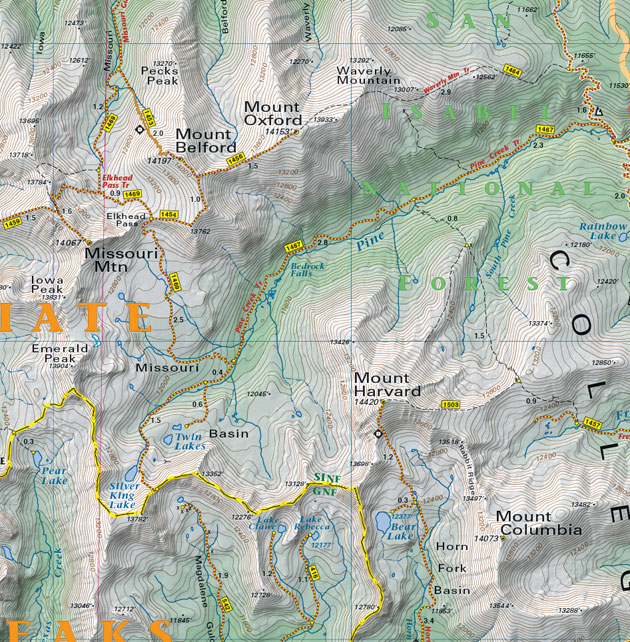
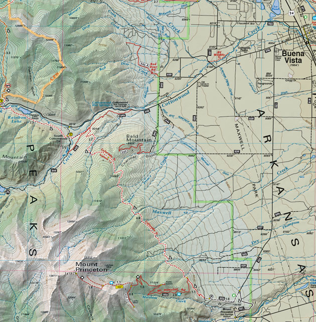
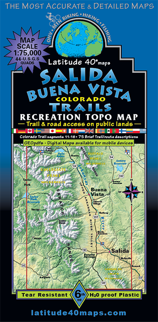
Salida - Buena Vista Trails
$14.95
A one-time price of $14.95 will be added to your order.
- Description
For orders outside the U.S., please email us.
Also available as an Avenza Digital Map
Map Coverage covers all or part of 44 USGS 1:24,000 7.5-minute topographic maps
- North Twin Lakes
- South Bonanza
- East Badger Creek
- West Taylor Park
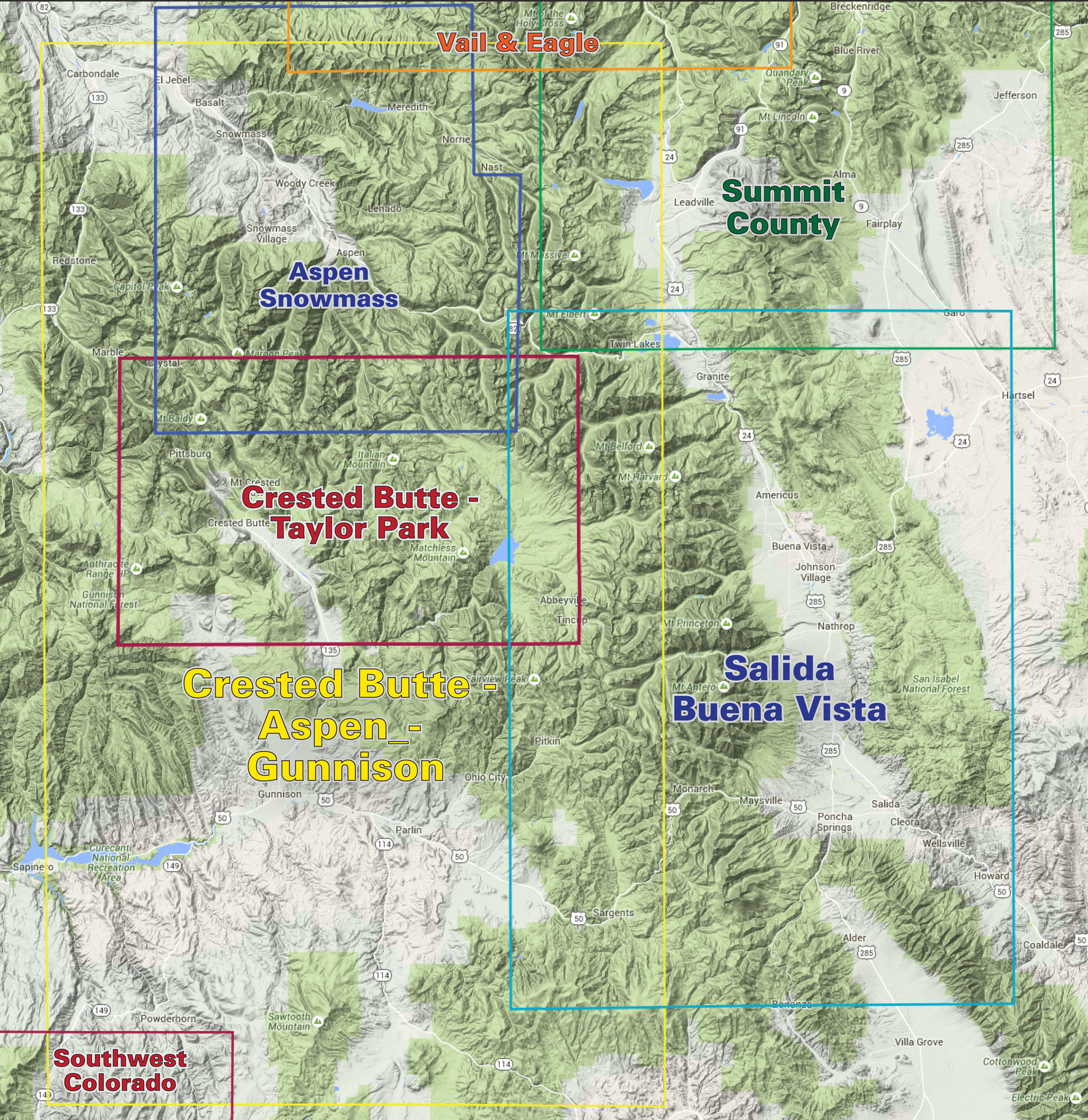
click to open locator
Size
- 38"x 25" flat
- 8.25"x 4.25" folded
Scale 1:75,000; 1 inch = 1.2 miles or 1.9 km
Contour Interval 80 feet with shaded relief base
Latest Edition 6th - 2024
Notes
- UTM & latitude/longitude grid
- Trails for mountain biking, hiking, fishing, OHV