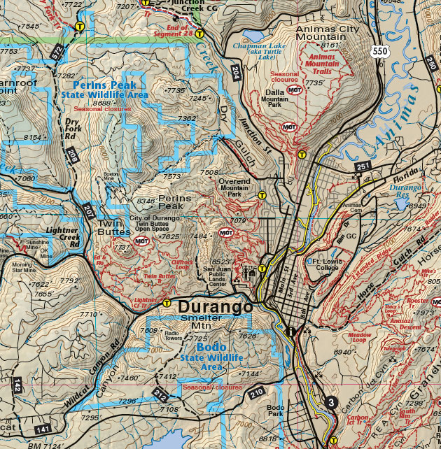
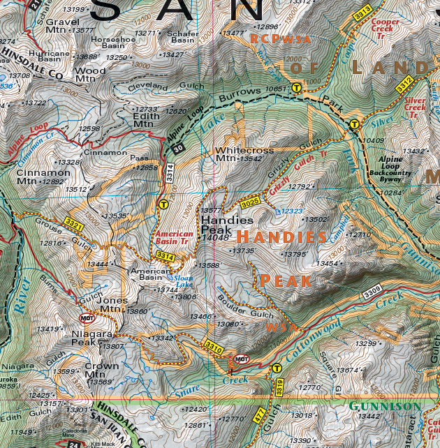
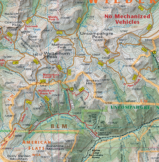
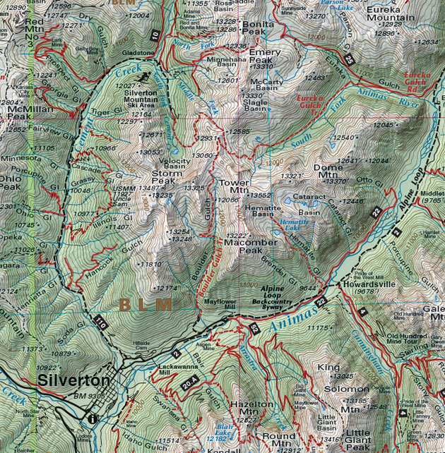
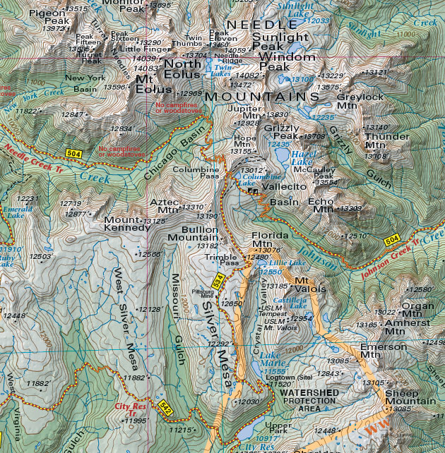
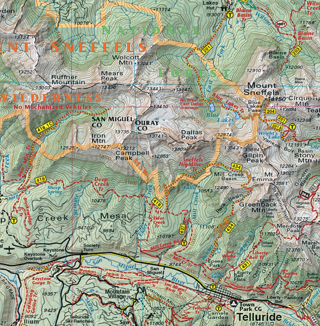
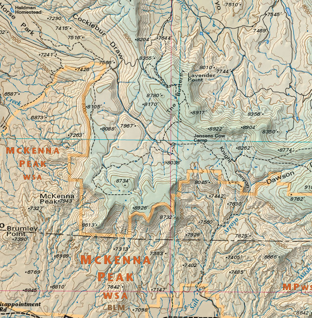
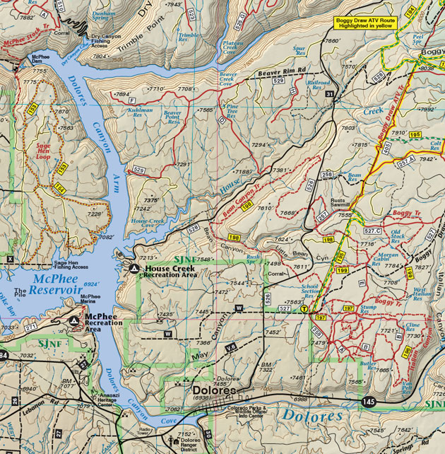
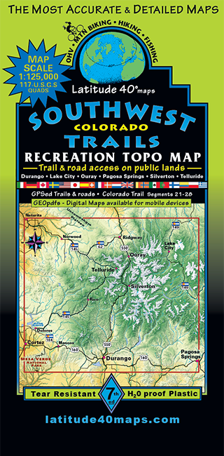
Southwest Colorado Trails
$14.95
A one-time price of $14.95 will be added to your order.
- Description
For orders outside the U.S., please email us.
Also available as an Avenza Digital Map
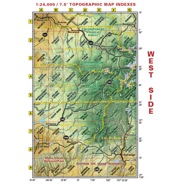
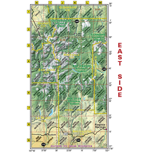
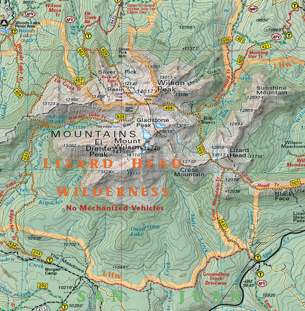
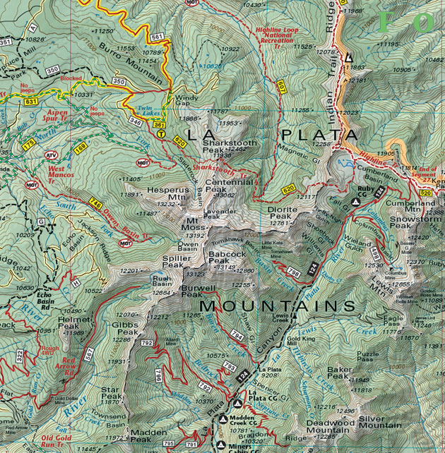
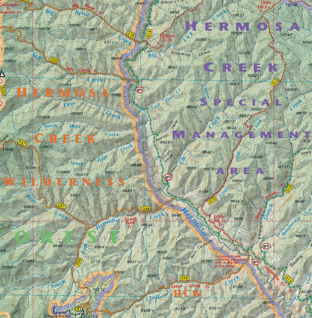
Map Coverage covers all or part of 117 USGS 1:24,000 7.5-minute topographic maps:- North - Ridgway State Park
- South - Mesa Verde National Park
- East - Pagosa Springs
- West - Cortez

click to open locator
- 39"x 25" flat
- 8"x 4" folded
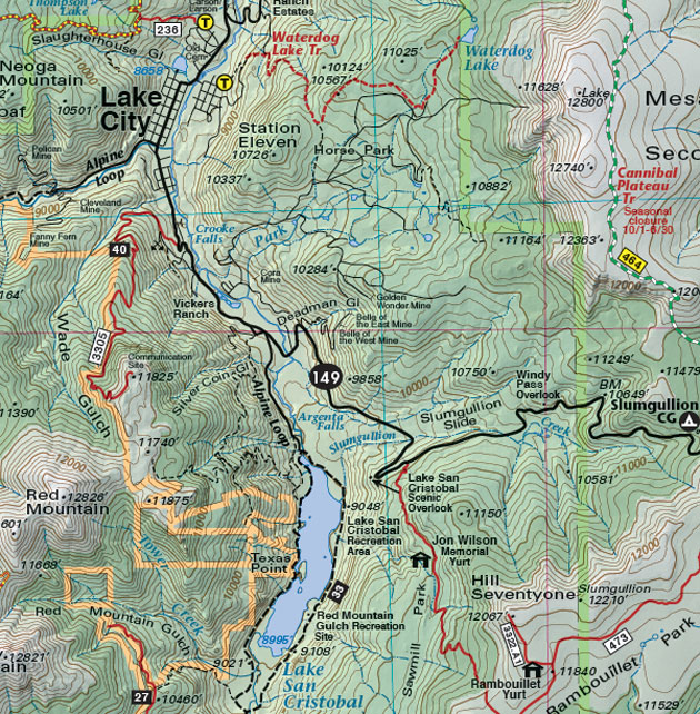
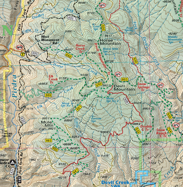
- Seven-color, double-sided map
- Highlighted public access trails and roads for hiking, mtn. biking, OHV, and equestrians
- Includes all or parts of eight wilderness areas and all the classic routes in this beautiful region
- latitude and longitude map borders with UTM coordinates