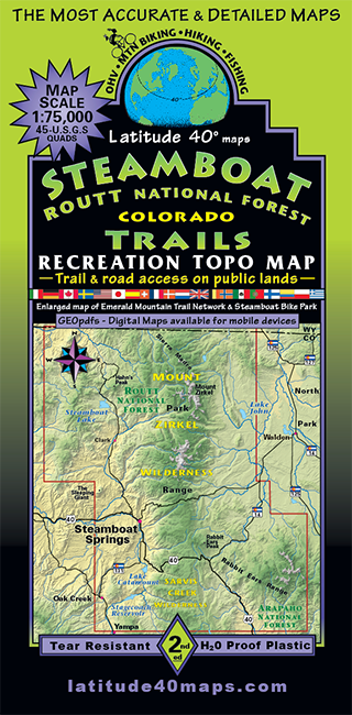
Steamboat - Routt National Forest Trails
$14.95
A one-time price of $14.95 will be added to your order.
- Description
For orders outside the U.S., please email us.
Also available as an Avenza Digital Map
Map Coverage:
Covers all or part of 45 USGS 1:24,000 7.5-minute topographic maps- Northern map edge - Wyoming/ Colorado border
- Southern map edge - Town of Yampa/ Top of Red Dirt Res/ Top of Wolford Res.
- Eastern map edge - Lake John SWA, Sheep Mtn, Green Ridge, Poison Ridge
- Western map edge - Town of Oak Creek, The Sleeping Giant (Elk Mtn)
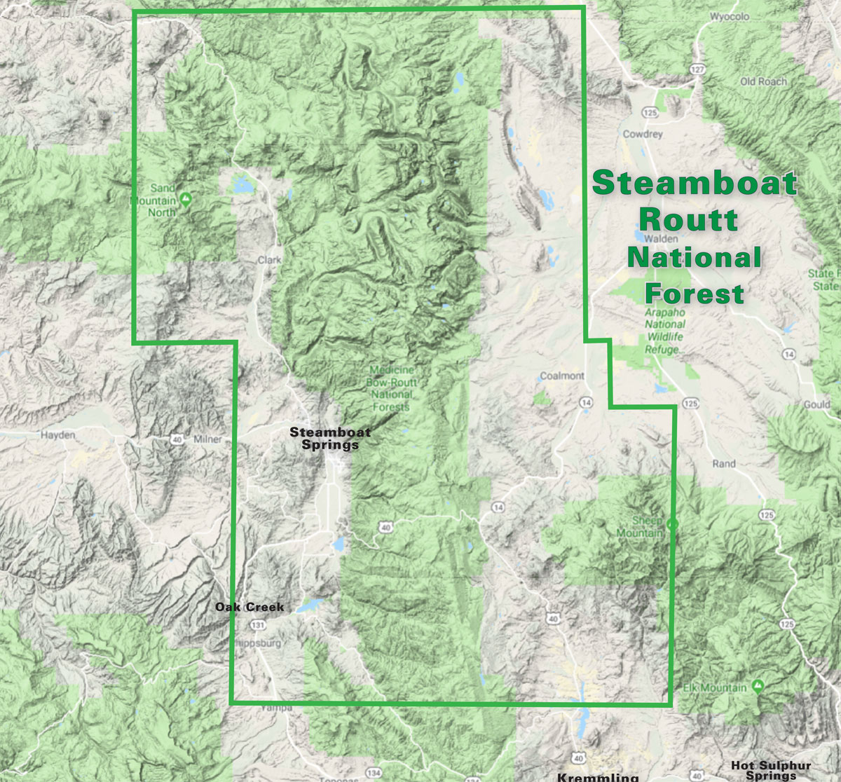
click to open locator
- 38.25” 25.2” flat
- 8.4"x 4.2" folded
- 2-sided - north half on one side, south half on reverse side
- Enlarged map of Steamboat Springs (Scale 1:37,500 or 1”= 0.6 mi. or 1.0 km.) showing Emerald Mtn Tr. Network and Steamboat Bike Park
- Latitude and longitude map borders/ UTM coordinate grid
- List of 63 Trail/Route options with difficulty ratings, distance, length and elevation gain and loss
- Public access trails and roads for all types of backcountry recreationists
- GEOpdfs of this map will be available for mobile devices on our website soon
- Stagecoach State Park, Steamboat Lake State Park, Pearl Lake SP. Dozens of State Wildlife areas, State Trust Lands and BLM lands.
- Mount Zirkel Wilderness, Sarvis Wilderness, Troublesome WSA
- The CDT (Continental Divide National Scenic Trail) from Wyoming/Colorado border south to Poison Ridge