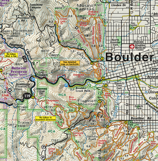
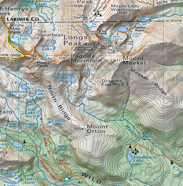
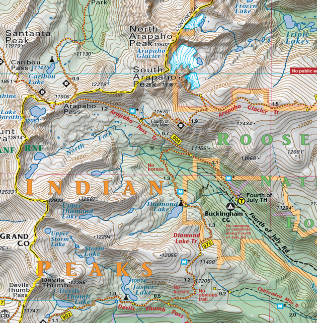
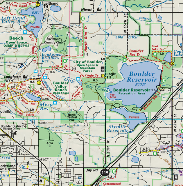
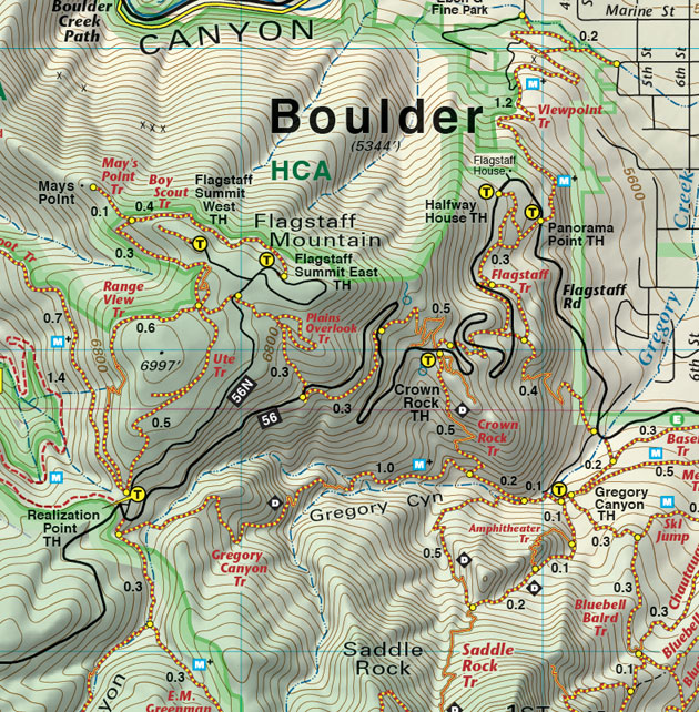
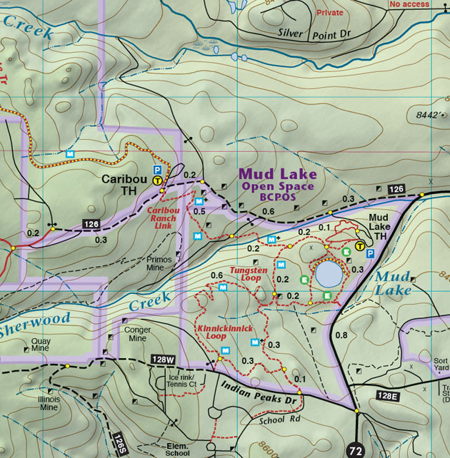
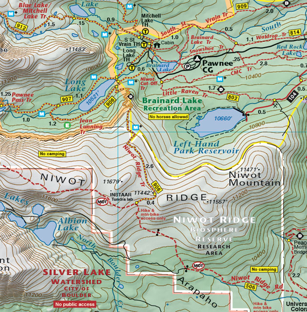
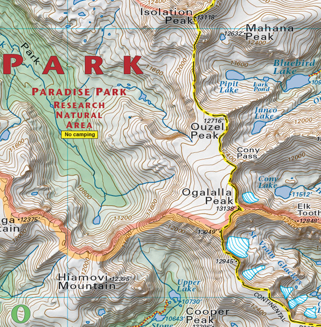
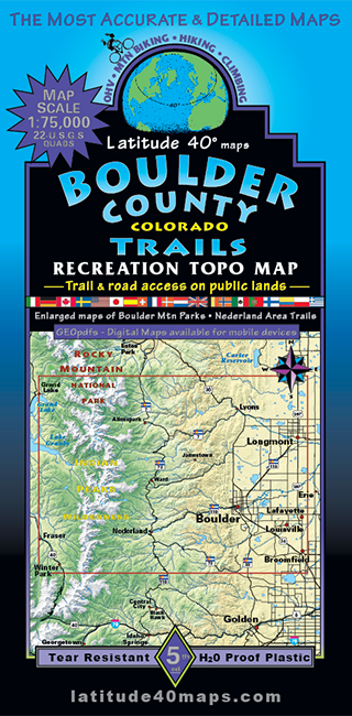
Boulder County Trails
$14.95
A one-time price of $14.95 will be added to your order.
- Description
For orders outside the U.S., please email us.
Also available as an Avenza Digital Map
Map Coverage covers all or part of 22 USGS 1:24,000 7.5-minute quad maps- North - Grand Lake - Longs Peak - Pinewood Springs - Rabbit Mountain Open Space
- South - Mary Jane Ski Area - Rogers Pass - Broomfield
- East - Longmont - Lafayette - Broomfield
- West - Grand Lake - Fraser - Winter Park
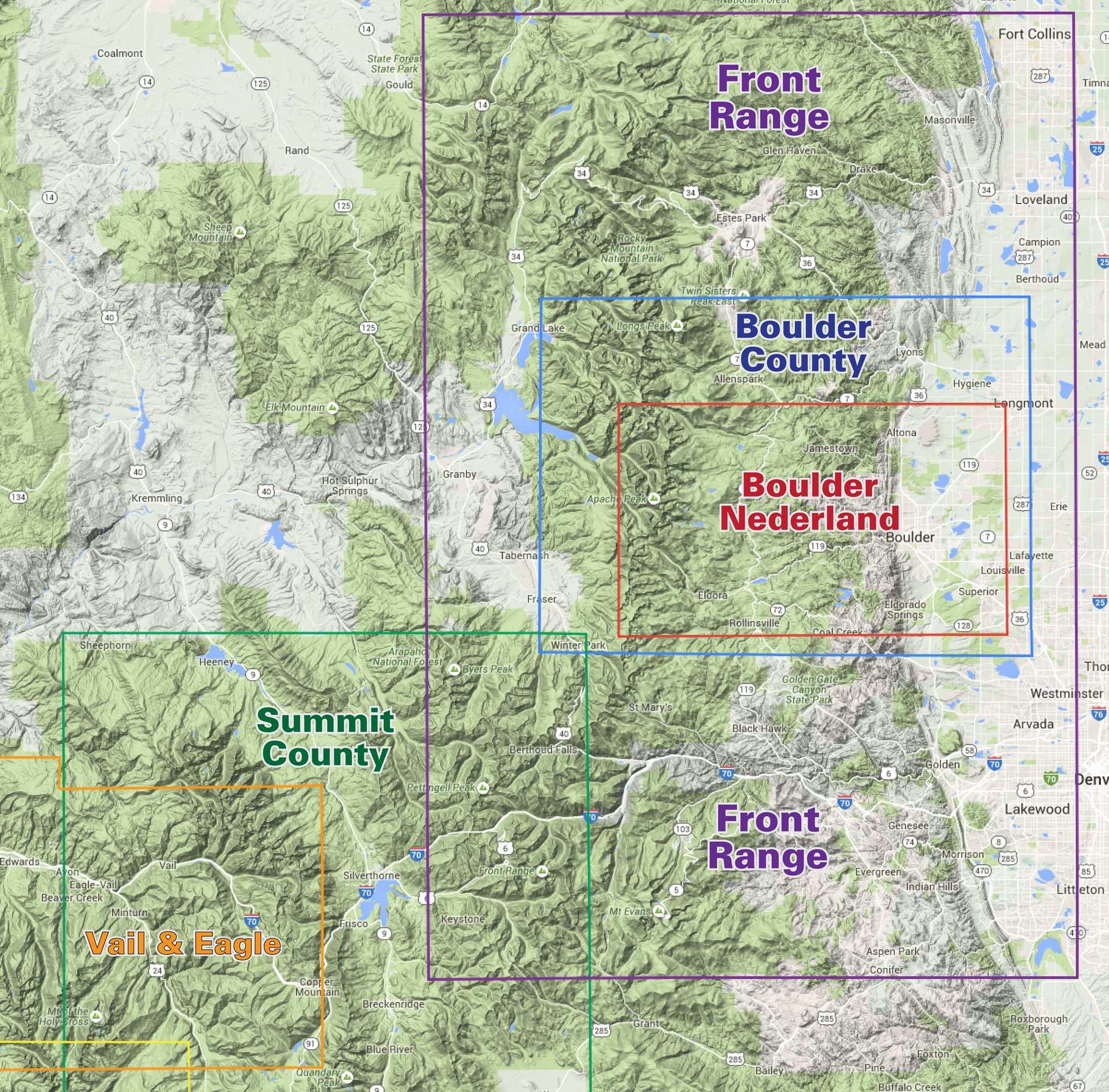
click to open locator
- 39.3" X 25.2"
- folded- 8" X 4"
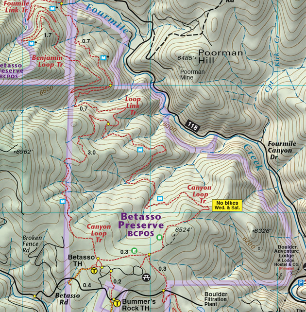
- 40 trails descriptions with elevation/distance profiles
- Indian Peaks Wilderness
- southern Rocky Mountain National Park
- James Peak Wilderness
- Boulder Mountain Parks and Open Space
- Nederland area trails
- Roosevelt National Forest
- color-coded elevation tinting
- hundreds of miles of GPS-surveyed travel routes
- GPS mileage between junctions
- latitude and longitude map borders with UTM coordinates