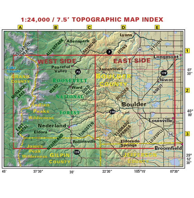
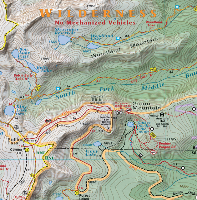
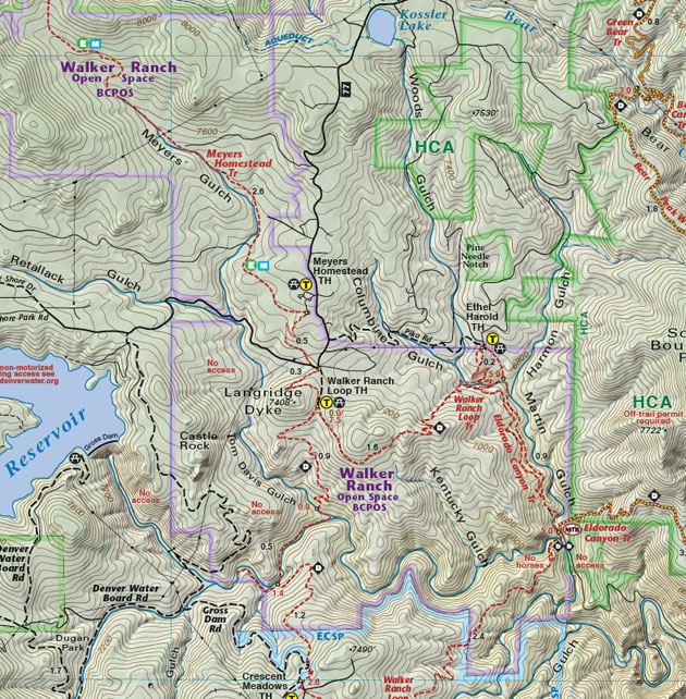
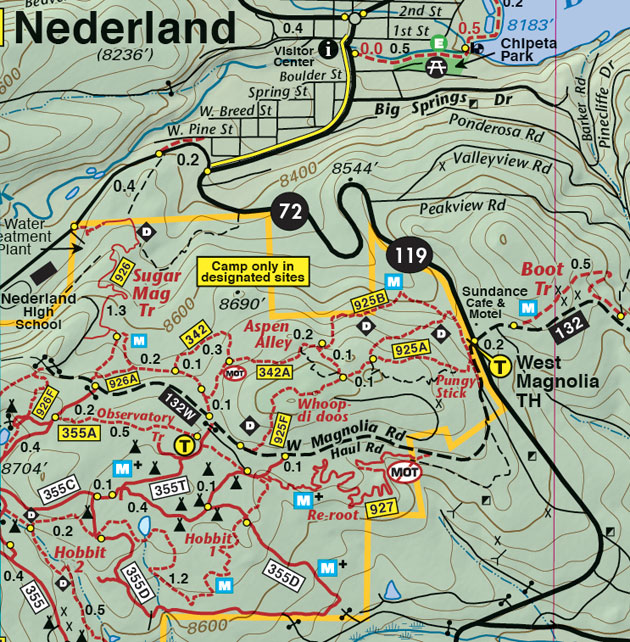
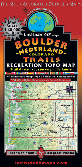
Boulder - Nederland Trails
$14.95
A one-time price of $14.95 will be added to your order.
- Description
For orders outside the U.S., please email us.
Also available as an Avenza Digital Map
Map Coverage covers 18 USGS 1:24,000 7.5-minute quad maps:- North - St. Vrain Glaciers and Peaceful Valley
- South - East Portal and Rollinsville
- East - Louisville
- West - Devil's Thumb and Rollins Pass
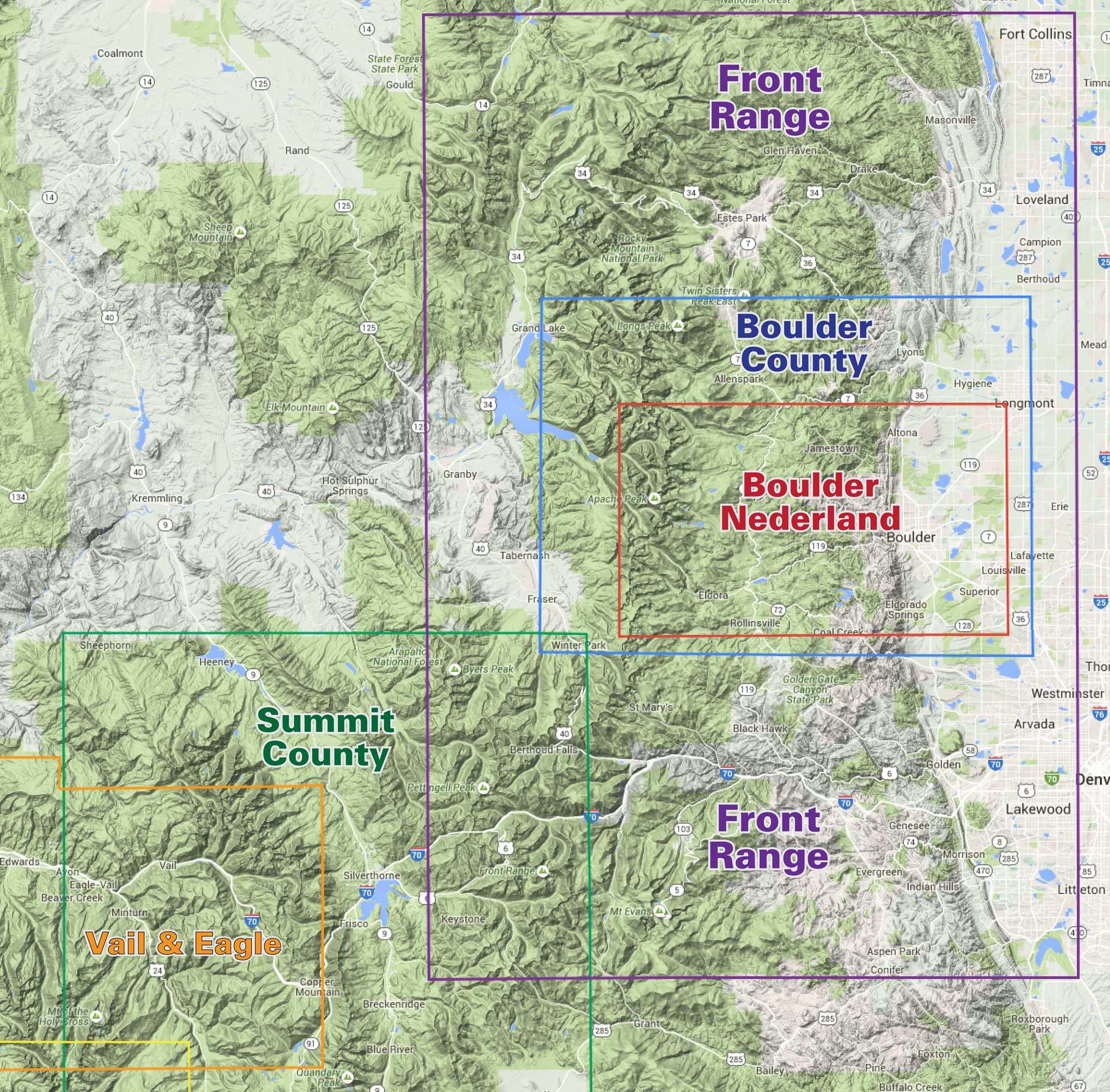
click to open locator
- 39"x 25" flat
- 8"x 4" folded
- Includes the east side of Indian Peaks Wilderness
- Includes the foothills east of the Peak to Peak highway
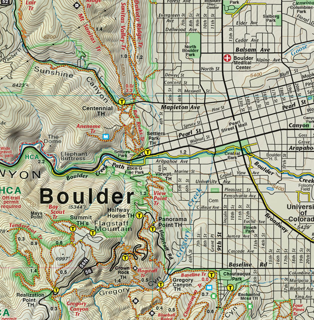
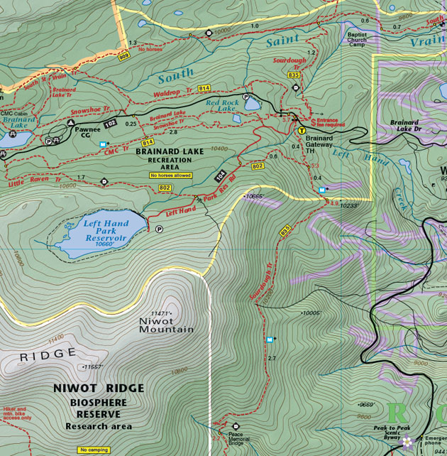
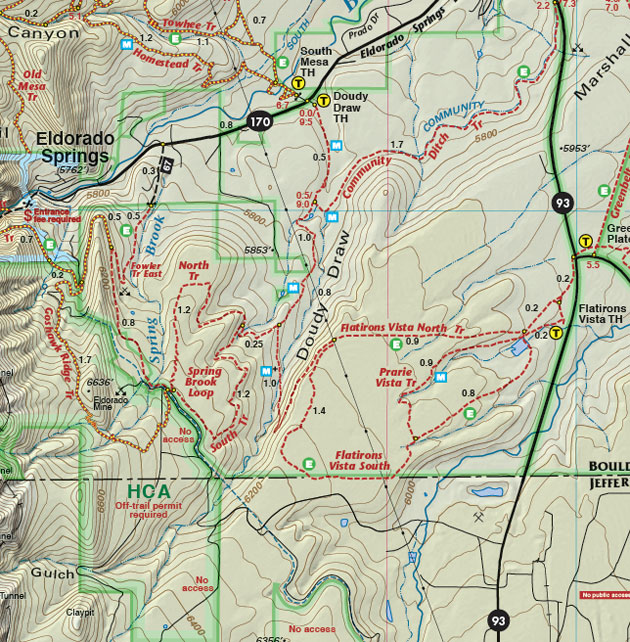
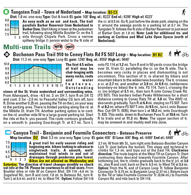
- 48 trail descriptions
- 20 elevation profiles