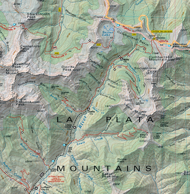
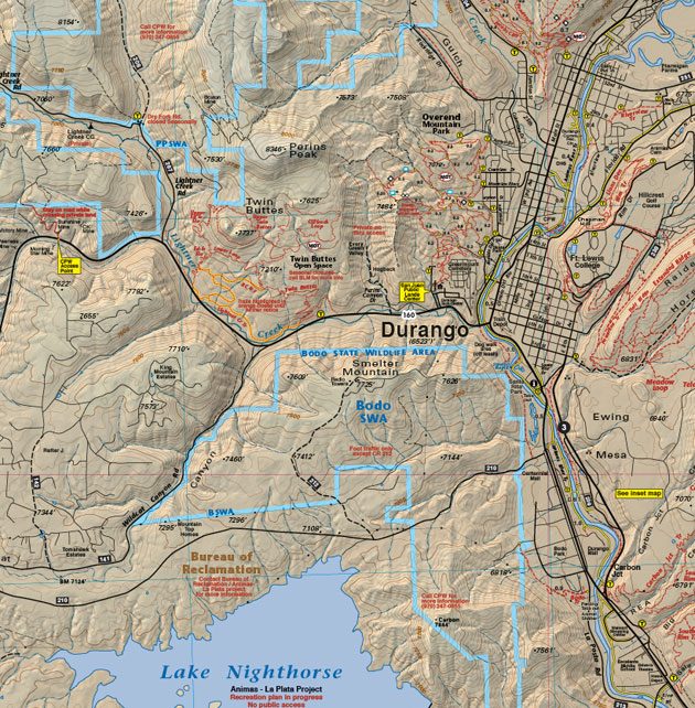
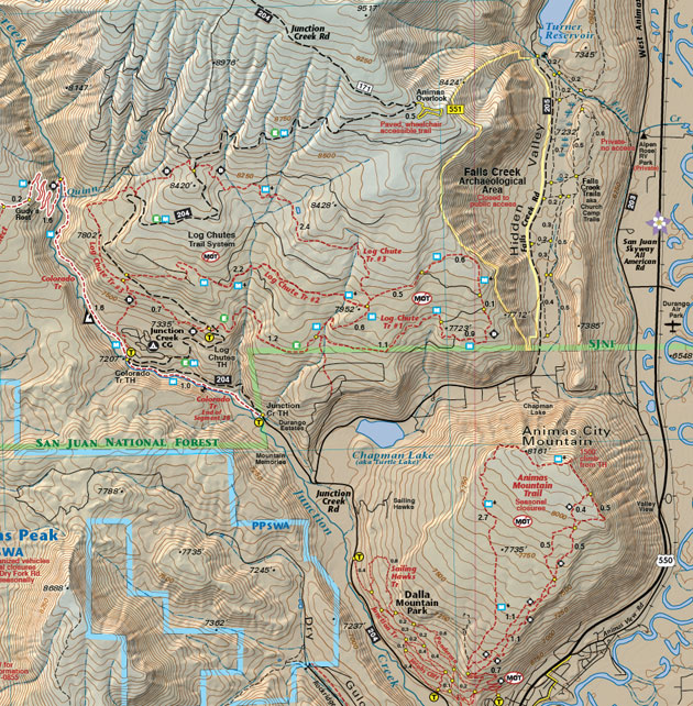
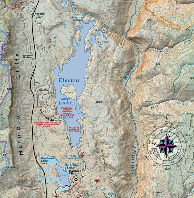
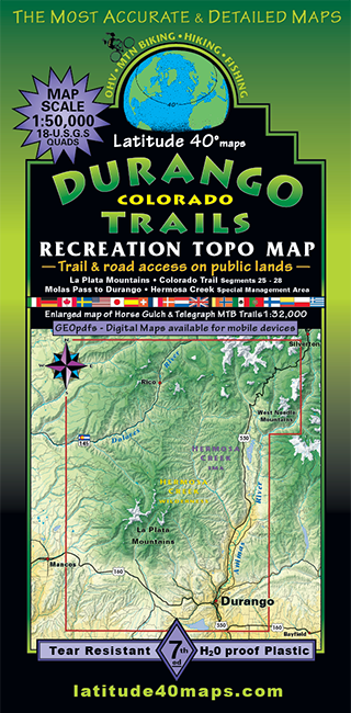
Durango Trails
$14.95
A one-time price of $14.95 will be added to your order.
- Description
For orders outside the U.S., please email us.
Also available as an Avenza Digital Map
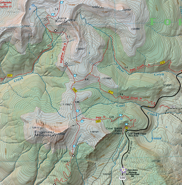
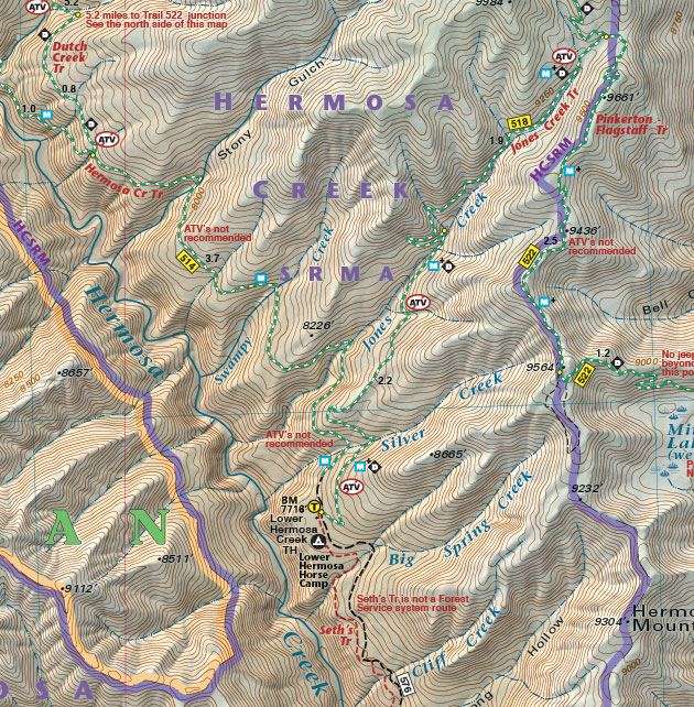
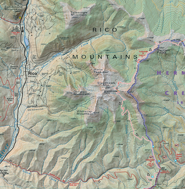
Map Coverage covers all or part of 18 USGS 1:24,000 7.5-minute topographic maps- North - Molas Pass
- South - City of Durango
- East - Molas Lake
- West - western La Plata Mountains

click to open locator
- 39.3"x 25.2" flat
- 8"x 4" folded
- latitude and longitude map borders with UTM coordinates
- GPSed trails and roads
- Mileages and Difficulty ratings