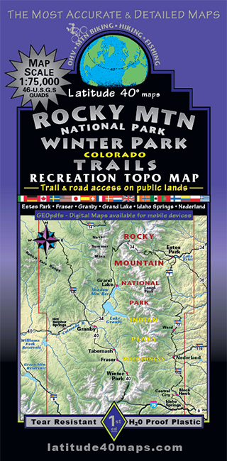
Rocky Mountain National Park - Winter Park
$14.95
A one-time price of $14.95 will be added to your order.
- Description
For orders outside the U.S., please email us.
Also available as an Avenza Digital Map
Map Coverage:
Covers all or part of 46 USGS 1:24,000 7.5-minute topographic maps, including all of Rocky Mountain National Park, 7 Wilderness Areas, Arapaho National Recreation Area, Colorado State Forest State Park. Includes Peak to Peak Scenic Byway (State Hwys. 7, 72 and 119) from Central City/ Black Hawk to Estes Park. Also covers Trail Ridge Rd. Scenic Byway and The Colorado River Headwaters Scenic Byway in Rocky Mtn. National Park.- North - Owl Ridge to Crystal Mountain
- South - Berthoud Pass
- East - Estes Park - Nederland - Central City
- West - Hot Sulfur Springs
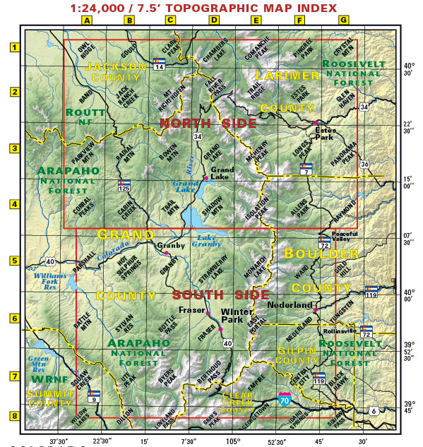
click to open locator
- 39"x 25" flat
- 8"x 4" folded
- Continental Divide Trail route from Troublesome Pass (Rabbit Ears Range) to Jones Pass (Vasquez Mtns)
- UTM & Latitude/Longitude Grid
- GPSed trails & roads
- Tear-resistant, water-proof plastic
- This map overlaps the Summit County Trails map to the south, Boulder County Trails map to the east and Steamboat Routt NF to the northwest