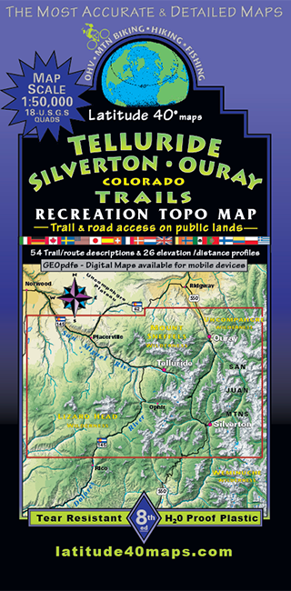
Telluride - Silverton - Ouray Trails
$14.95
A one-time price of $14.95 will be added to your order.
- Description
For orders outside the U.S., please email us.
Also available as an Avenza Digital Map
Map Coverage covers all or part of 18 USGS 1:24,000 7.5-minute topographic maps
- North - 7 miles north of Ouray
- South - 3 miles south of Lizard Head
- East - 6 miles east of Silverton
- West - Western boundary of Lizard Head Wilderness

click to open locator
Size
- 39"x 25" flat
- 8"x 4" folded
Scale 1:50,000; 1"= 0.8 miles or 1.3 km
Contour Interval 50 feet with shaded relief base
Latest Edition 8th - 2024
Notes
- Seven-color, double-sided map
- Latitude and longitude map borders with UTM coordinates
- This map connects with the Durango map for continuous coverage of the western San Juan Mountain range