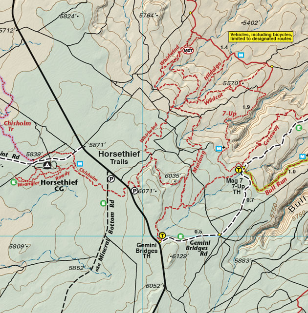
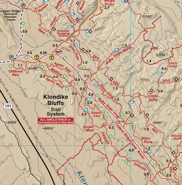
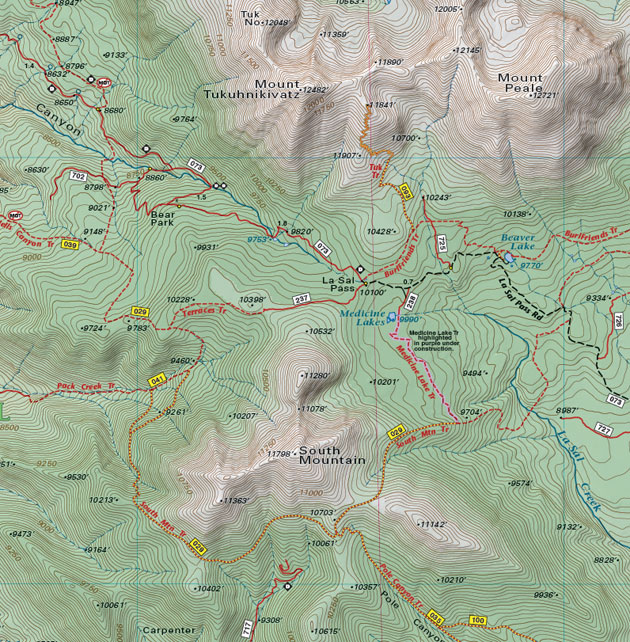
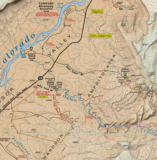
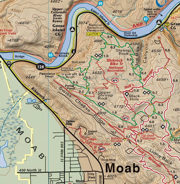
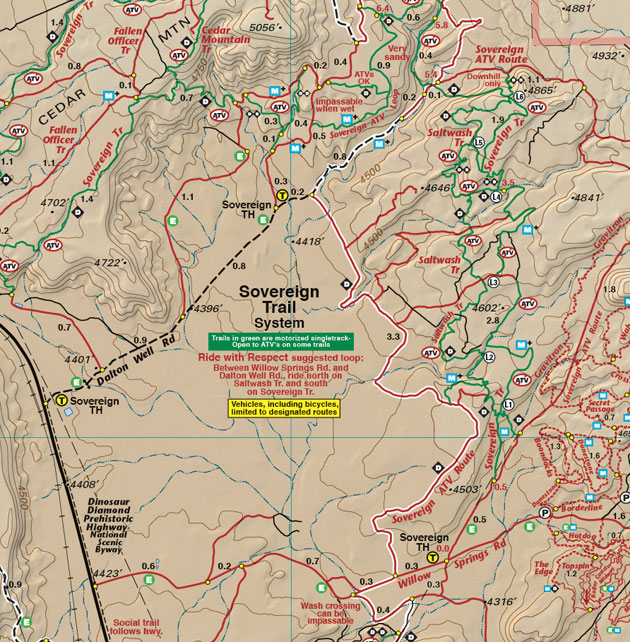
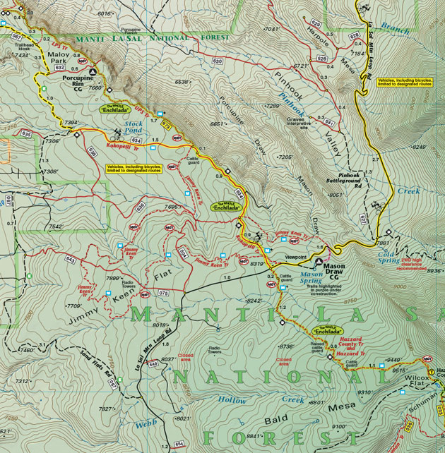
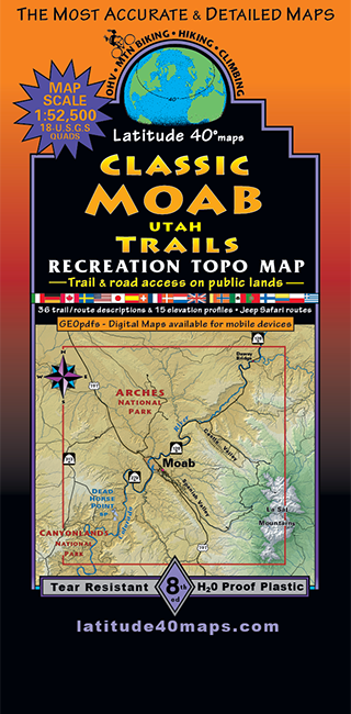
Classic Moab Trails
$14.95
A one-time price of $14.95 will be added to your order.
- Description
For orders outside the U.S., please email us.
Also available as an Avenza Digital Map
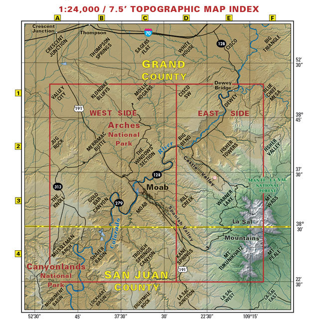
Map Coverage covers all or part of 18 USGS 1:24,000 7.5-minute topographic maps- North - Klondike Bluffs
- South - Canyon Rims Recreation Area
- East - La Sal Mountains
- West - Island in the Sky
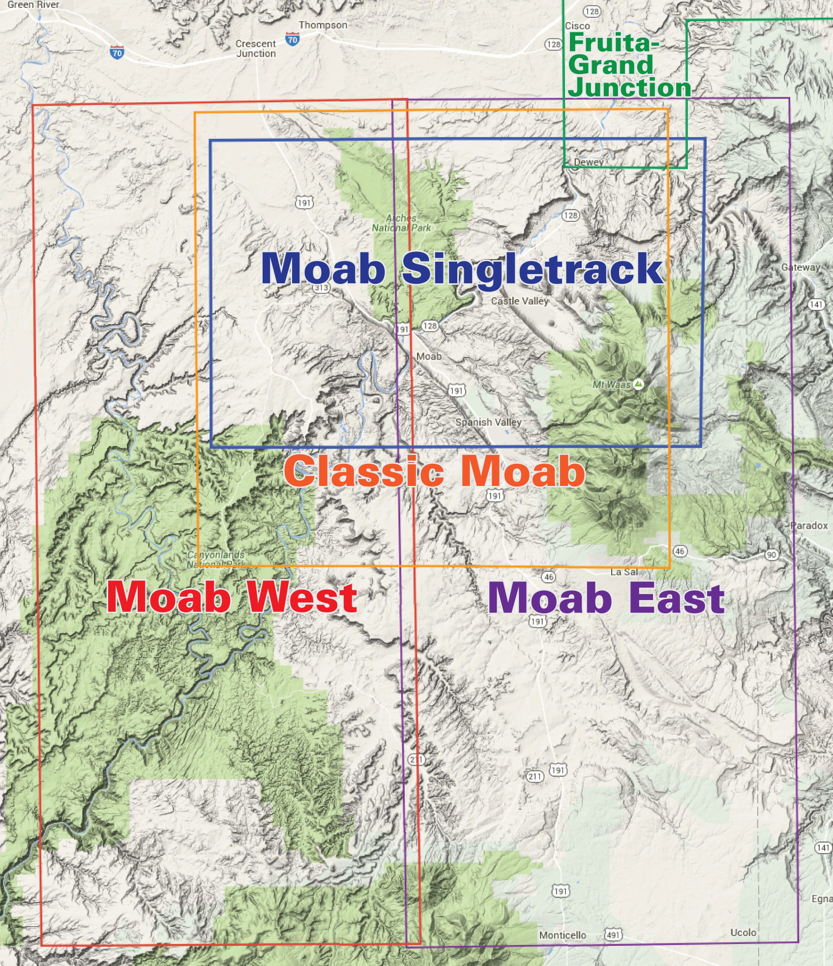
click to open locator
- Includes the latest new trails in the Moab area